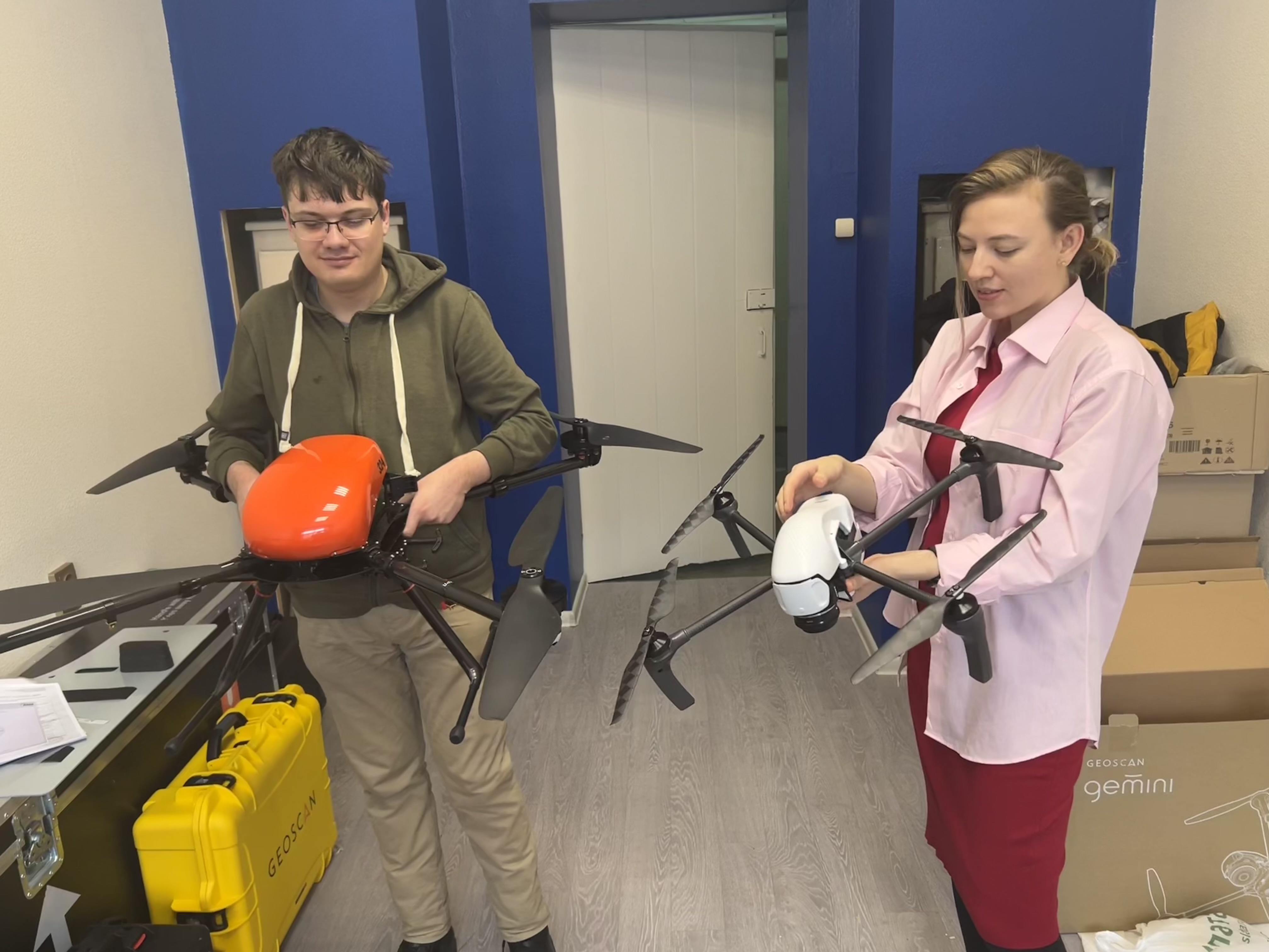
Advanced drones were purchased for INRTU department of Mine Surveying and Geodesy
INRTU has purchased two unmanned aircraft systems: Geoscan 401, equipped with survey equipment (Sony camera, AGM laser scanner), and Geoscan Gimini.
Beside aerial photography, Geoscan 401 drone complex can do airborne laser scanning, which will allow students to build more detailed three-dimensional models and get more accurate topographic maps. With the help of the purchased equipment, it is possible to make larger scales maps (1:200, 1:500).
This new advanced equipment can be used in an array of areas, including mining, topography, construction and land management, mining, oil and gas, forestry, electric power, archeology, agriculture, and landfill control.
Employees of the Department of Mine Surveying and Geodesy have successful experience of implementation of projects in the areas mentioned above. So, in 2020, the Department carried out aerial photography of 718 hectares, including the villages of Taloe and Solyanaya, to develop protective measures against flooding.