Specialists of Siberian School of Geosciences created a technology for modeling risks of dangerous geological processes in mountainous regions
Specialists from Siberian School of Geosciences (SSG) created technology for surveying inaccessible areas with difficult terrain. The system is designed to model risks of rockfalls, landslides and mudslides; also, it can be used to calculate the indicators needed for solving management tasks. The work is conducted as a part of the “i.GeoDesign” strategic project within "Priority 2030" program.
Alexander Parshin, Scientific Director of Siberian School of Geosciences, said that the hardware and software complex consists of original drones for multispectral and LIDAR surveys. The new technology includes a differential geodetic system and author software modules for data processing and analysis.
Geoinformation technology enables monitoring of inaccessible areas with slope angles up to 90 degrees, taking into consideration fractures and deformations in sub-centimeter spatial resolution.
Alexander Parshin worked on the project together with junior researchers Alexey Kosterev and Svetlana Gantimurova, and student Vladimir Erofeev. The development received legal protection as know-how of Irkutsk Technical University.
Alexander Parshin shared his plans,

"We have implemented and tested methodological and algorithmic positions, and created a prototype of the drone system. Now the project team is focused on the development of a shell program that will automate all the data analysis processes.
Currently, the technology is designed for rockfall research. We intend to improve the prognostic system, use it to study the reference sites, and develop mudflow forecasting algorithms."
The project manager added that they surveyed more than 70 inaccessible areas along the Baikal Rift Zone in 2022. 15 employees and students of Siberian School of Geosciences were involved in experimental and commercial work in addition to the project team.
Alexander Parshin informed,
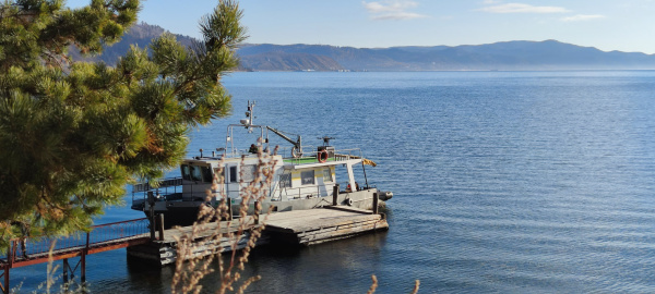
"The study area includes areas that pose a landslide and rockfall danger to the infrastructure of Circum-Baikal Railroad cultural heritage site. The work was ordered by JSC "Russian Railways." "It is difficult to find out the information by traditional methods as it is dangerous for life and health of the specialists. That is why the fieldwork was carried out from the board of a vessel without disembarking. The processes were modeled with the help of an efficient computing cluster. As a result, we obtained clear three-dimensional models with information about the most dangerous places. Besides, we got quantitative data about the necessary volumes of rock material, and we modeled likely trajectories of rockfalls."