INRTU has presented a new version of an unmanned aircraft for comprehensive geophysical surveys
The Siberian School of Geosciences (SSG) at INRTU has developed a new version of an unmanned aircraft for high-precision comprehensive geophysical surveys. The project is implemented as part of the "Priority 2030" Program.
The research work on designing the aircraft structure for "absolute" accuracy magnetic surveys was initiated by Alexander Parshin, the scientific supervisor of the Siberian School of Geosciences, in 2015. By 2020, he had developed an optimal design for the airborne geophysical system based on compact and cost-effective aircraft magnetometric systems. Alexander Parshin specified the locations and reasons for placing the engines, electronics, and sensors of the measurement systems. The researcher also developed a program to study interference, the results of which showed that there are no electromagnetic disturbances affecting the sensors.

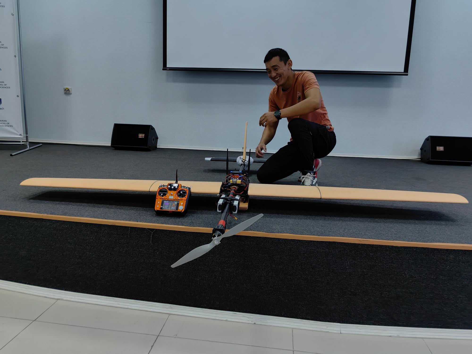
The design of the UAV carrier was created by aviation engineer Munko-Jargal Badmaev, who studied in the master's program "Information Technologies in Mining". As a research engineer at the Siberian School of Geosciences, Munko-Jargal continues to improve the development, involving colleagues and students in the testing.
The 2024 version of the unmanned aircraft is considered by the polytechnic team to be the most suitable for commercial projects for leading companies in Russia. The UAV has competitive features in terms of production cost, flight quality, and data transmission.
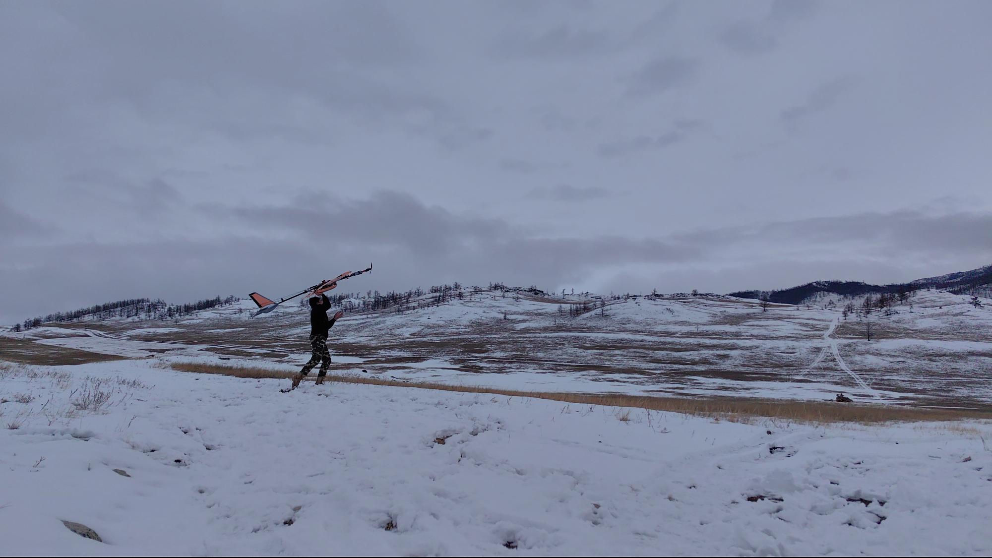
According to Alexander Parshin, the unmanned aircraft is made from accessible materials using 3D printing and CNC milling technologies. By lowering the flight altitude, the developers are not worried about financial losses and therefore obtain more accurate results in surveying geological anomalies.

"The team at the Siberian School of Geosciences created a lightweight yet strong UAV capable of carrying a high-precision magnetometer and a scintillation gamma-ray spectrometer with a detector while weighing only eight kilograms.
Key elements of the UAV's design avoid any electromagnetic interference in the magnetometer sensor and the need for software corrections that reduce survey accuracy. We achieved this result by using non-magnetic materials, special design solutions, and an original tail mechanism design," said Alexander Parshin.
When working in steppe regions with terrain variations up to the first hundreds of meters, the polytechnic team obtains data comparable to what multirotor UAVs collect. However, the UAV from the Siberian School of Geosciences operates at speeds two to three times faster and has a significantly longer flight time.
"We can study areas covering hundreds of square kilometers from a single takeoff point, while multirotors can only cover tens of square meters. This simplifies geological work in promising regions of Russia and the world," summarized Alexander Parshin.
Among the advantages of the development compared to its counterparts, INRTU staff highlight the ability to use the UAV for work on the continental shelf and over bodies of water. The system simultaneously conducts two types of geophysical surveys—magnetic and radiometric.
The complex is optimal for use in the steppes of Central Asia and the Arctic. Depending on the terrain of the work site, the polytechnic team chooses one of the UAV modifications. During the 2024 field season, the polytechnic team will use the airborne geophysical system to complete a project in the Transbaikal region.