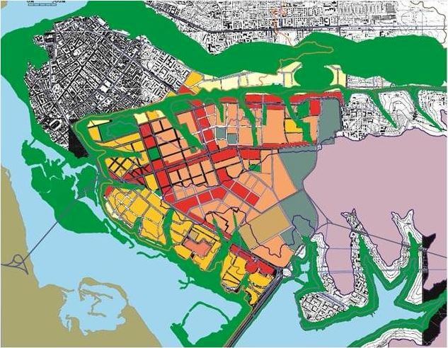
Space models digitalised at INRTU can be used to generate masterplans
Professor Andrey Bolshakov of INRTU is working on the project 'Configurations of spatial grids as a tool for resolving disputes of values in architecture and construction'. The result of the research will be a digital mathematical model that can be used to prepare a general plan for the building, the campus and the city.
The research is part of the strategic project «Digital industrial technologies — i. DIT» under program the Priority 2030. The work is led by Professor Andrei Bolshakov, Head of the Department of Architectural Design, who has extensive research experience.
He focuses on spatial grids — models for organising space. These are networks connected by functional units. Grids are seen as geometric connections of cells, such as corridor and vestibule systems. The parameters of the cells, the layout and the connections between them are modified. These modifications allow the ability to use grids to solve certain problems in architecture and in urban planning.

«I see spatial grids as a tool to resolve value conflicts in society. The bearers of values are people — residents, developers, lawyers, financiers, etc. Grids are also the consequence of rules to help avoid chaos in society. There are motivations for the spatial environment, including public health, well-being, lack of separation, beauty, and compositional expressiveness.
In conducting my research I have aimed to find out how to balance the interests of citizens and businesses by modifying networks in architecture. The transformation of space should generate positive emotions and bring benefits," says Prof. Bolshakov.
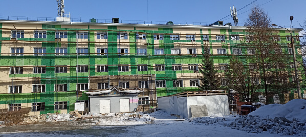
A good example of space modification is the renovation of Dormitory No. 6 on the INRTU campus. Andrei Bolshakov was involved in creating the design for its renovation. The scientist created an informative and diverse lattice of the curtain wall facade without changing the arrangement of window openings. The research involved students who are learning to design a double-decker house for a family of five. The assignment requires them to build a composite grid in such a way that the dwelling is inexpensive and of the highest quality possible.
According to the professor, the grids can be used to create a mathematical model that is important in developing a master plan for anything from a building to a city, as well as the natural framework of a region. The model is easy to convert into digital data. The proposed tool may be interesting to the employees of the Architecture Department of the Angara region and the Irkutsk administration.
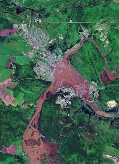
«Models consist of matrices and graphs, analysing which makes it easy to determine which streets will become the busiest and most popular. In addition, the coordination of development networks and the landscape avoids the effects of accidents. For example, if houses were not built in floodplains, the devastating flood in Tulun would not have caused so much trouble," the developer pointed out.