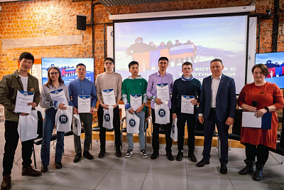
INRTU geodesy surveyors' report on laser scanning and aerial surveying took the second place at the international conference
Students and teachers of the Department of Surveying and Geodesy of INRTU took the second place at the XV International Conference "Problems of Hydrocarbon and Ore Mineral Deposits Development". The forum took place on October 18-21 in Perm National Research Polytechnic University (PNRPU)
The program of the conference comprised six sections. Students and young scientists fr om Tyumen, Samara, Moscow, St. Petersburg, Irkutsk, and Krasnoyarsk presented 79 oral and poster presentations. The presentations were dedicated to geology, oil and gas engineering, mining and petroleum electro-mechanics, and other prospective areas of subsoil use.
Students of the 4th year represented Priangarie at the forum. They made two presentations in the Geodesy and Geomechanics section, defending their projects remotely.
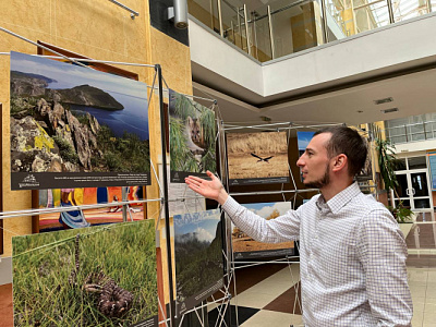
Senior students Angelina Protasova and Ruslan Druz prepared a scientific report in co-authorship with the senior lecturers of the chair Alina Kshanovskaya and Sharif Ohunov. The Polytechnic students compared airborne laser scanning (ALS) and aerial photography (APS). These methods are used to create topographic plans of the terrain, including high altitude areas overgrown with trees.
They said that aerial laser scanning allows the construction of a detailed three-dimensional model, obtaining an accurate plan by permeating laser measurements through the vegetation cover. The research team looked at the Khokhsolakh site in the Republic of Sakha (Yakutia), wh ere they worked in the summer of 2022, as a specific site. To date, the polytechnicians have created a digital topographic plan at a scale of 1:1000.

During the study it was determined that laser scanning captures the terrain with the accuracy of 73-97%, whereas the accuracy of aerial photography is much lower - 23%. In addition, VLS can be used at any time of the day or night. It is better to use this method in forested areas, with significant differences in absolute altitudes, and in built-up areas.
Ruslan Druz reported that the team successfully approved the research results, taking second place. An article corresponding to the subject of the presentation will be published in the industry publication "Mining Information and Analytical Bulletin".
The second report was prepared by Ivan Asafiev, Artem Serebrennikov and Alexander Kopytov. Irina Karpova, senior lecturer at the department, acted as supervisor for the student team. The work analysed data from the GeoScan 401 quadcopter obtained during the summer expedition.
According to Ivan Asafiev, creation of digital elevation and terrain models is necessary to solve the problem of uncontrolled deforestation. The students take into account the advantages of laser scanning. They conducted experiments using a GeoScan 401 with a lidar equipped with an AGM laser scanner with a geodesic class receiver.